
For over 25 years, while telescopes like Hubble peered into the distant universe, NASA’s Landsat 7 satellite had a different, equally vital mission: watching our home planet. Orbiting 700 kilometers (about 435 miles) above us, this unsung hero has silently documented Earth’s ever-changing surface, providing crucial data that shaped our understanding of environmental shifts, urban growth, and natural disasters. As Landsat 7 concludes its remarkable quarter-century journey, retiring this month, its archive of over 3 million images stands as a powerful visual record of how Earth has transformed in our lifetime.
Contents
Launched in 1999 with a modest five-year plan, Landsat 7 far exceeded expectations, becoming one of the longest-operating Earth observation missions. It wasn’t designed to capture cosmic wonders, but rather to focus its instruments squarely on the land beneath us, capturing detailed images of forests, deserts, glaciers, cities, and coastlines. This continuous stream of data allowed scientists and policymakers to track changes that impact our lives, from shrinking ice caps to expanding cities and the aftermath of major environmental events.
A Constant Watch on a Changing Planet
Think of Landsat 7 as Earth’s dedicated photographer, taking consistent, high-resolution pictures from space. Its primary instrument, the Enhanced Thematic Mapper Plus (ETM+), captured images across multiple light wavelengths, giving researchers insights invisible to the naked eye. This capability allowed scientists to differentiate between types of vegetation, monitor water quality, map land use, and track environmental health with unprecedented detail over wide areas.
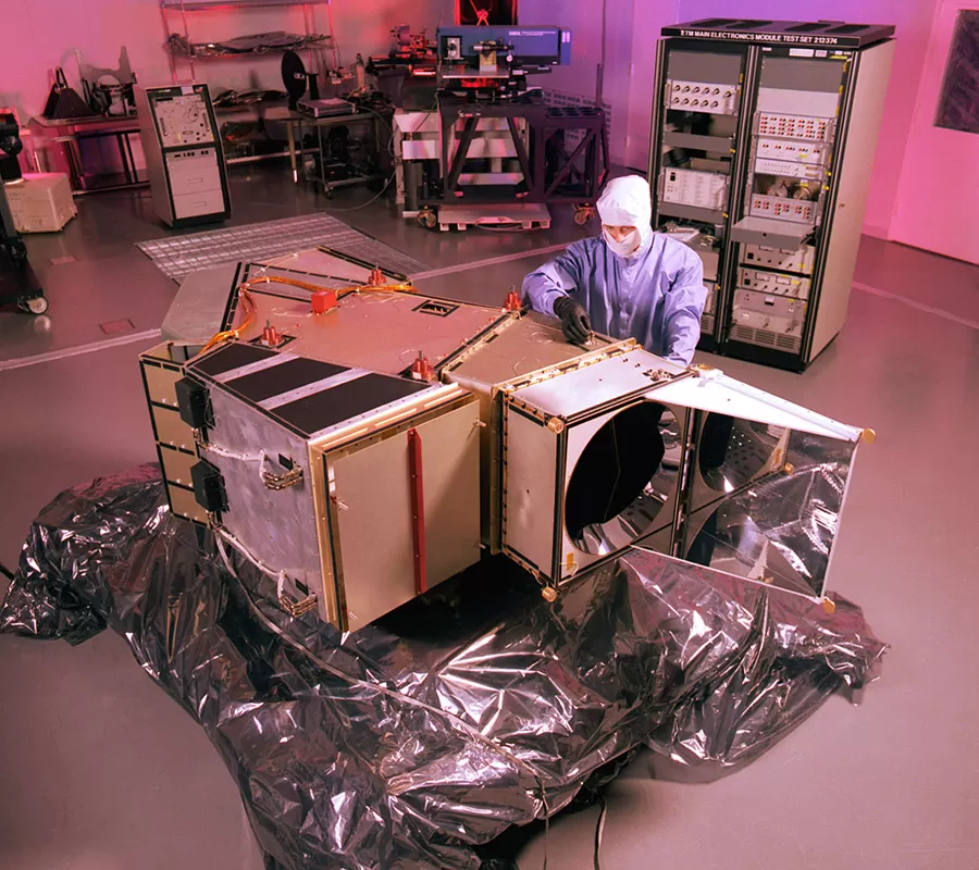 The Enhanced Thematic Mapper Plus (ETM+) instrument, key sensor for the Landsat 7 Earth observation satellite, in a clean room.
This long, consistent record is invaluable. By comparing images taken months or years apart, researchers could precisely measure how landscapes were changing. This data is like a time-lapse video of our planet, revealing gradual processes like desertification or rapid events like forest fires and floods.
Seeing the Impact: From Conservation to Disasters
Landsat 7’s images weren’t just pretty pictures; they were powerful tools for understanding and responding to real-world challenges. For conservationists, they helped monitor delicate ecosystems, like coral reefs. Detailed views allowed mapping and tracking the health of these vital marine structures around the globe.
 Vibrant satellite image from Landsat 7 showing circular coral reef atolls surrounding lagoons, highlighting coastal ecosystems.
The satellite’s view was also crucial for monitoring natural disasters. When events like Hurricane Katrina struck in 2005 or the Deepwater Horizon oil spill occurred in 2010, Landsat 7 provided critical overhead views showing the extent of flooding or the spread of oil slicks, aiding response efforts. It documented the devastation from the Haiti earthquake in 2010 and the vast reach of the Australian bushfires in 2019-2020.
Its images also laid bare the dramatic impact of human activity, from the geometric patterns of agricultural expansion into forests to the unchecked sprawl of urban areas worldwide. Viewing these changes from space offers a unique perspective on our planet’s delicate balance and the pressures placed upon it. For example, images starkly revealed deforestation in the Amazon basin, showing clear-cut areas and new settlements fanning out into the rainforest.
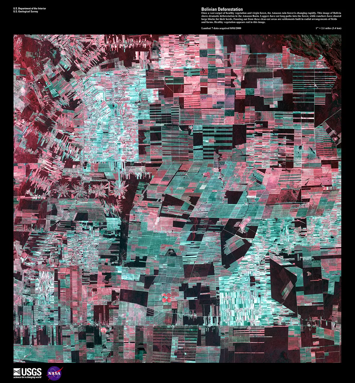 Landsat 7 satellite image showing dramatic patterns of deforestation and agricultural settlements fanning out into the Amazon rainforest in Bolivia.
Glaciers, too, were under Landsat 7’s watchful eye. Tracking glacial retreat, like the significant melting observed at Argentina’s Upsala Glacier over decades, provided undeniable evidence of climate change and its effect on Earth’s ice sheets.
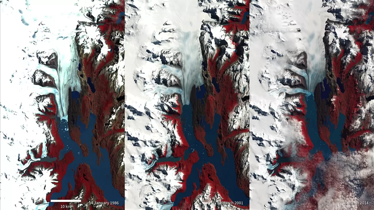 Comparison of Landsat images from 1986, 2001, and 2014 showing the significant retreat of the Upsala Glacier in Argentina over time.
Even iconic landscapes, like the dramatic coastlines of Iceland’s West Fjords or the unique patterns of Iran’s Dasht-e Kavir desert, were captured in stunning detail, showcasing the sheer beauty and diversity of Earth’s surface.
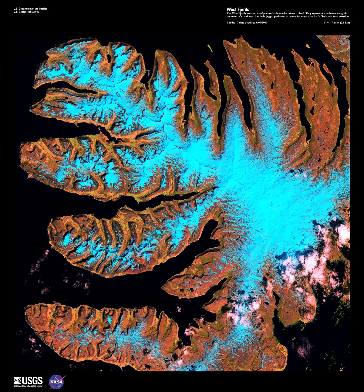 Satellite view from Landsat 7 capturing the rugged coastlines and peninsulas of the West Fjords region in northwestern Iceland.
The End of a Long Journey
After traveling billions of kilometers and delivering millions of images, Landsat 7 is finally being decommissioned. Its farewell is a carefully orchestrated process: power systems drained, heaters switched off, and communication silenced. It won’t crash immediately but will drift in orbit for over half a century before eventually succumbing to Earth’s gravity and burning up harmlessly in the atmosphere.
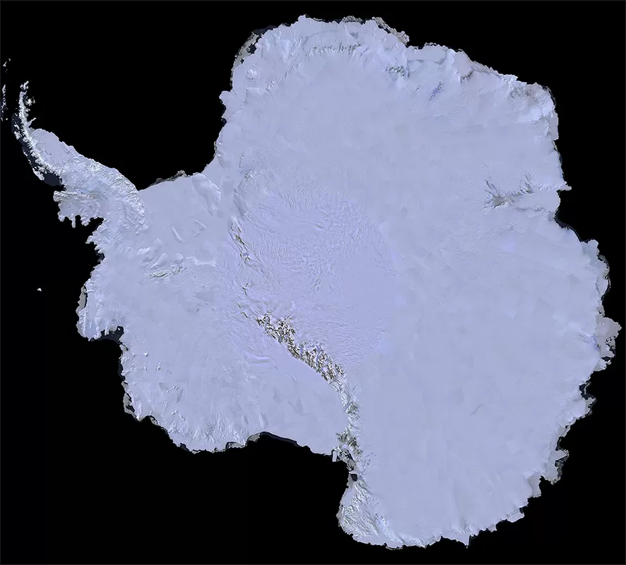 Full continent mosaic of Antarctica created using data collected by the Landsat 7 Earth observation satellite.
The mission’s longevity and the sheer volume of data it collected have created an unparalleled record for Earth science. Its legacy lives on through its extensive archive, which remains freely available, and through its successors, Landsat 8 and Landsat 9, which continue the vital work of monitoring our planet from space. While Landsat 7 may not have the same public fame as its stargazing cousins, its quiet dedication fundamentally changed how we understand the ground beneath our feet and the dynamic forces shaping our world.
The retirement of Landsat 7 is a moment to appreciate how looking down from space is just as crucial for science and our future as looking up.